
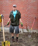
 mobile
Category: scajaquada
05/12/08 10:17 - ID#44316
scajaquada creek backwash
I read your message about Scajaquada Creek and wanted to send a quick message. My husband and I explored a good 1.5 miles through the tunnel today. It is pretty interesting in there. My email is [removed] if you are interested in talking about our adventure.
Oh weird. Did you get pictures? Which side did you enter from? And how deep is the water in the tunnel? [If I go, do I wear hip-waders or shit-kickers?]
I haven't gotten out there yet but my curiosity is weirdly piqued. I'm amazed at how little information is available about the creek, especially considering its location, the huge scope of the tunnel project, and that the whole thing is just a disaster of environmental management.
We actually do a sport called geocaching
and we placed a cache in the tunnel. We went in through Forest Lawn. On Friday we hiked about 1 mile and then went back Sunday and went about 1.5 miles.
When first heading out Friday we assumed rubber boats that went to about our knees would be good. We were wrong and I got soaked. Basically when first entering the tunnel, it is mostly shallow...ankle deep. Back in about 2 or 3 hundred feet is a big grate that lloks like it used to be used to filter out large objects. You have to walk around that and right after that the water gets up to knee deep. We wanted to explore so badly that we ran back out and got hip waders. The water only satsy knee deep for about 50 or 60 feet and then from there on out it is 1/2 inch deep to ankle deep at most.
There are several off shoots of drainage tunnels and easily hours of exploration. The smell is manageable and really the water doesn't seem all that bad. I loved it. There are a few man-holes that allow some light, but for the most part it is really dark. My pictures are far from good. I can send you a few when I get home from work.
Biggest thing, obviously don't go alone. It is a little slippery and there are a few places where you could trip and really get hurt. Anything else I can answer let me know.
If you do go and want any company, let me know. If you go in about a mile, you'll find our geocache out in the open.
Huh, thanks for the info. If I get together a spelunking expedition I'll keep you posted.
Some more scraps of information that I've collected: the tunnel used to be an outlet for Buffalo and Cheektowaga storm drains; Buffalo has since diverted them but Cheektowaga hasn't. And as I was driving down the street one day it occurred to me that when the creek crosses Main St, it flows under the street and over the subway. Krazy.
- Z
 WOW, what an adventure. Spooky and somewhat uncomfortable sounding though... I am not sure I would be enthusiastic or brave enough to go on this spelunking expedition, however. Would <3 LOVE <3 to read about your explorations and enjoy vicariously. Just knowing about the existence of this and the fact that people actually go geo-cacheing there is blowing my mind. The hidden tunnels might make good dumping bodies for corpses by the mafia...
 Permalink: scajaquada_creek_backwash.html
Words: 506
Category: scajaquada
04/14/08 10:34 - ID#44012
weird preoccupation
, you'd pass through Black Rock and North Buffalo before reaching the reflecting pool at the Historic Society and Hoyt Lake at Delaware Park. This is all very familiar due to the eponymous expressway and bike path. Were you to go upriver from Hoyt Lake you'd pass under Delaware Ave and into Forest Lawn Cemetery. The creek ends in a culvert at Main St near Delavan, but um, there's nothing on the other side.That's when it gets fascinating. Between 1921 and 1937 the Scajaquada Creek was buried in an enormous 3.5 mile long tunnel from Main St & Delavan Ave all the way out to Cheektowaga, where it emerges at Pine Ridge Rd near Walden Ave. The city has been built up so densely since then that looking at satellite photos it's extremely difficult to tell where the creek goes. Current government maps don't show the river at all, or show it as a straight line between the two points. There's very little mention of the project
or the tunnel anywhere online. For all intents and purposes, there is a 3.5 mile section of the creek that just doesn't exist anymore. If you continued upstream, you'd be outside for less than two miles before you found yourself underneath the Galleria Mall. USGS lists the creek's source as some subdivision in Lancaster, 13 miles east of the Niagara River.In researching the creek, I dug up a scan of a 1901 USGS map of the Buffalo area and pastede it onto Google Earth, which is fascinating in its own right
[18.7M]. [Use Google Earth's opacity slider to time-warp 107 years.]It's going to be tough to keep myself from urban-spelunking it this summer. Gross.
- Z
ps for those of you who give a shit: the creek goes underneath the Canisius athletic complex, and underneath Florida St. It then turns south underneath a footpath, underneath the Kensington Expressway, and along the path to Fillmore Ave. From there it goes between an industrial complex and a railroad before continuing along the appropriately-named Scajaquada Street. At Bailey Avenue, it no longer follows the street, instead going behind a row of backyards, crossing Genesee St at Kearns Ave. It flows underneath Schiller Park and Villa Maria College before emerging again at Pine Ridge Road.


Permalink: weird_preoccupation.html
Words: 442
Author Info

Date Cloud
- 10/11
- 08/10
- 07/10
- 06/10
- 05/10
- 04/10
- 03/10
- 02/10
- 01/10
- 12/09
- 11/09
- 10/09
- 09/09
- 08/09
- 07/09
- 06/09
- 05/09
- 04/09
- 03/09
- 02/09
- 01/09
- 12/08
- 11/08
- 10/08
- 09/08
- 08/08
- 07/08
- 06/08
- 05/08
- 04/08
- 03/08
- 02/08
- 01/08
- 12/07
- 11/07
- 10/07
- 09/07
- 08/07
- 07/07
- 06/07
- 05/07
- 04/07
- 03/07
- 02/07
- 01/07
- 12/06
- 11/06
- 10/06
- 09/06
- 08/06
- 07/06
- 06/06
- 05/06
- 04/06
- 03/06
- 02/06
Category Cloud
More Entries
My Fav Posts
- This user has zero favorite blogs selected ;(
 Lovey at Niagara Falls